
Insights
Evidence, not noise — clear geospatial insight
Short, decision-ready notes and case-led perspectives on Earth observation, GeoAI, hydrospatial analytics, and digital twin intelligence—written for planners, program leads, and infrastructure decision-makers.

Coastal corridor
transport + shoreline resilience

River monitoring
change detection + indicators

Urban digital twins
3D context + planning layers

Coastal resilience
risk screening + adaptation
Topics we publish on: monitoring programs, corridor screening, coastal risk, water systems, and “digital twin ready” baselines.
What you’ll find
Practical insight formats
Risk briefs
Short, decision-ready notes linking hazards, exposure, and practical options.
Methods notes
Clear workflows, assumptions, and QA/QC—written to be auditable and repeatable.
Case snapshots
Real-world examples showing what we did, what changed, and what leaders can do next.
Focus areas
What we write about
A practical blend of EO, hydrospatial analytics, and delivery lessons—kept readable for decision-makers.
Monitoring & change detection
EO time series · indicators · clear reporting narratives.
Coasts, rivers & flood screening
Shoreline dynamics · exposure checks · resilience options.
Digital twins & 3D baselines
UAV/LiDAR · terrain · “digital twin ready” context layers.
GeoAI (where it helps)
Repeatable models · transparent assumptions · operational scale.
Insight pillars
Three decision-ready pillars
Three pillars that reflect our delivery scope
Request a topic
Decision-ready writing that connects methods, risk, and implementation—built for planners, program leads, and infrastructure owners.
Insight pillar
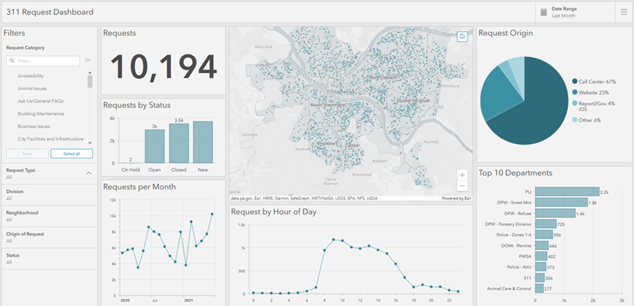
Decision support · dashboards · digital twin readiness
Strategic Geospatial Intelligence & Decision Support
How leaders use maps, models, and dashboards to prioritize investments, compare scenarios, and track outcomes with confidence.
Explore / request →
Insight pillar
Risk screening · early warning · adaptation options
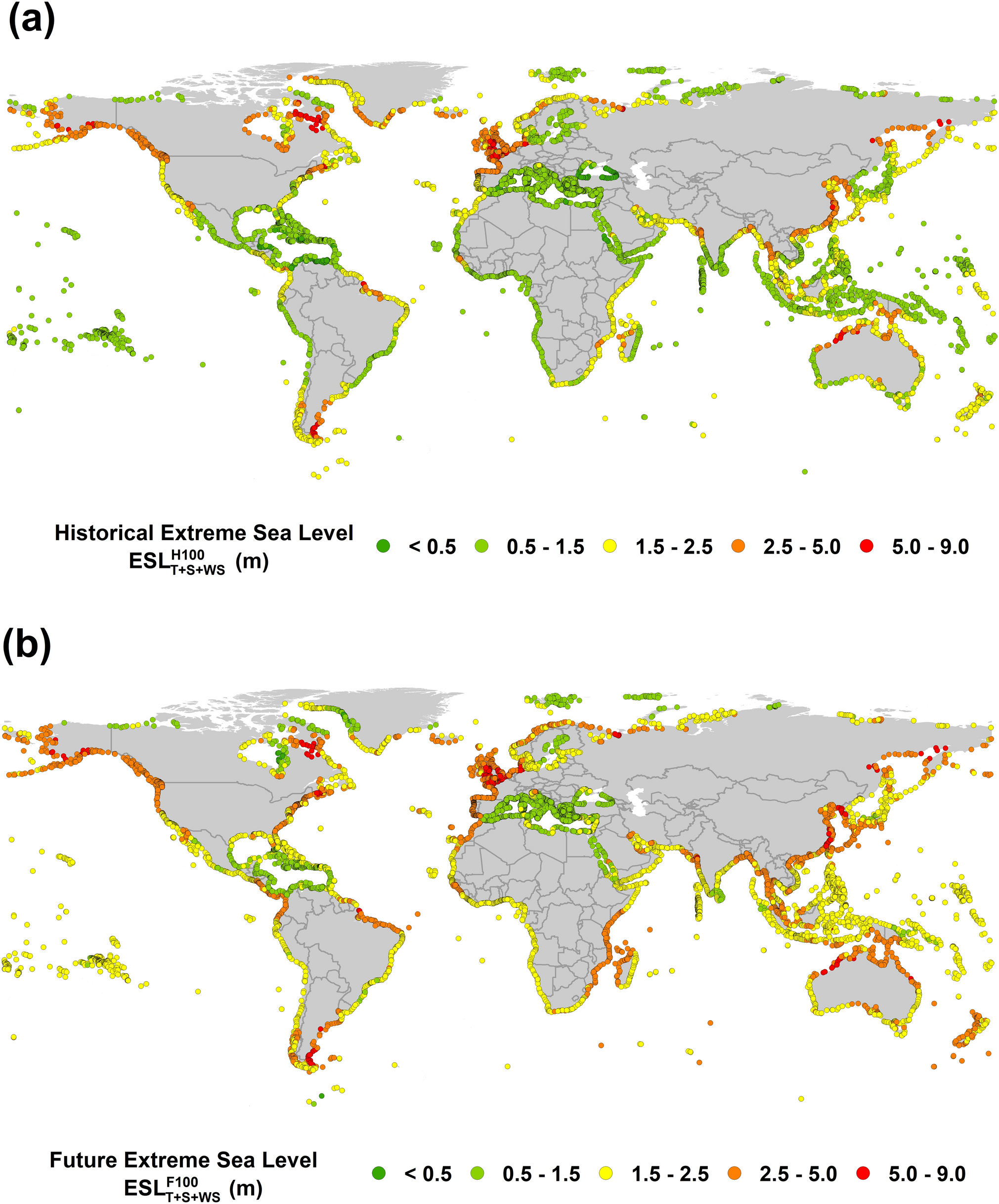
Climate Risk, Resilience & Disaster Intelligence
Practical approaches to map exposure, quantify uncertainty, and support preparedness and recovery across sectors.
Explore / request →

Insight pillar
Critical infrastructure · cascading risk · systems mapping
Infrastructure Interdependency & Systems Resilience
Location-aware models that reveal dependencies, failure pathways, and practical mitigation priorities for resilient services.
Explore / request →